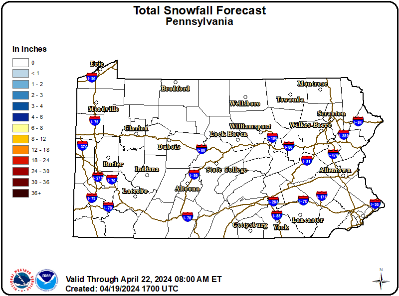
As a cold front continues to cross the region overnight into Thursday, temperatures are expected to fall into the low-to-mid 20s. This will allow for lingering water on untreated roadways to refreeze, potentially creating slick spots overnight into Thursday morning. Snow showers across portions of northern and western Pennsylvania will also continue overnight into Thursday morning, bringing additional light accumulations. While light, any accumulations could add to already slick conditions overnight and for the Thursday morning commute.
Motorists should use caution on the roads tonight and through Thursday morning. Allow for a little extra time to reach your destination. If you encounter slick roads, slow down and increase the distance between your vehicle and those that surround yours.