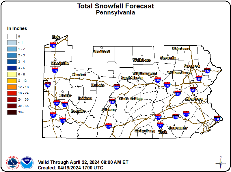
A period of accumulating wet snow will occur during the early to mid morning hours today as a compact, but potent upper level disturbance tracks east from South-Central PA to the Southern Poconos.
The snow will end to the west of Interstate 99 between 4 and 5 AM and become focused across the Middle Susquehanna Valley and Western Poconos between 5 and 8 AM.
Snow will likely stick on untreated roads and cause slushy driving conditions. Snow accumulations on colder, grassy surfaces will be 1 to 2 inches.
This short bout of wintry weather will impact the mid morning commute to work and school across portions of Central PA, mainly to the southeast of a line from Altoona to State College and Williamsport. This includes the Middle Susquehanna Valley and Western Poconos.
Use extra caution if you must travel this morning as potentially slick roads may lead to accidents. Slow down and allow plenty of stopping distance between you and the vehicle ahead. Avoid braking suddenly.