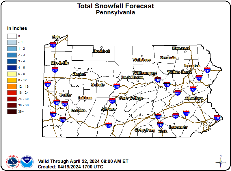
WHAT:
Heavy snow expected. Additional snow accumulation late Sunday and Sunday night of 4 to 8 inches. Storm total snow accumulation between 12 and 18 inches with localized accumulations up to 20 inches.
WHERE:
A portion of central Pennsylvania.
WHEN:
Until 1 PM EST Monday.
IMPACTS:
Travel will be very difficult to impossible. Widespread and prolonged travel disruptions are expected.
ADDITIONAL DETAILS:
Snow is expected to be heavy at times into this Sunday evening with accumulation rates of up to 1.5 inches per hour at times, before tapering to periods of lighter snow later tonight into Monday morning. Frigid temperatures and wind chills are expected during and after the winter storm. Some blowing and drifting snow is possible, mainly after daybreak Monday.
Consider delaying all travel. Motorists should use extreme caution if travel is absolutely necessary.